I’m really excited for today’s guest post. I’ve always found archaeology fascinating, and every now and then you hear about amazing ways technology has caused a breakthrough in our historical knowledge. Years ago when I ran my Monthly Round Up series of historical news, numerous pieces looked at this exact thing, such as when radar discovered a new Viking ship burial. That’s why I jumped at the chance to share this piece about LiDAR and archaeology from someone at the Drone as a Service team. Drone as a Service (DaaS) provides end-to-end drone solutions — including LiDAR, photogrammetry, and aerial mapping — to industries ranging from archaeology and heritage preservation to construction and agriculture. They’re going to be telling us about what exactly LiDAR is, and how it has been used in recent years to completely transform our understanding of historic sites.
Introduction: A World Hidden Beneath the Canopy
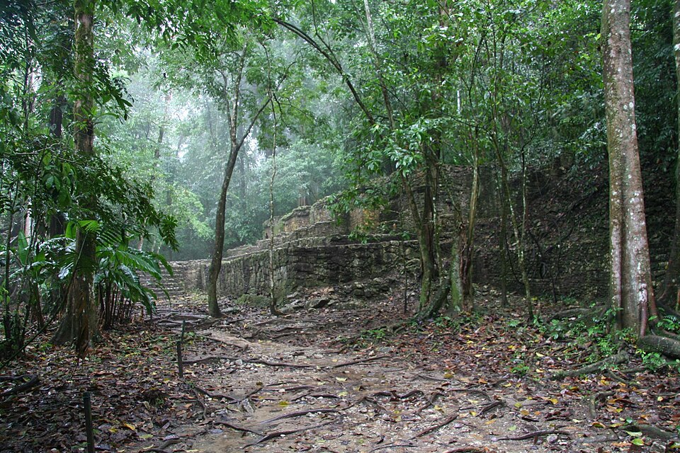
Picture an explorer standing at the edge of a tropical forest. Ahead lies an unbroken green ceiling, trees packed so tightly that daylight barely reaches the ground. Somewhere beneath that canopy, local rumours and old chronicles hint at ruins: a fallen wall, a stone platform, a temple swallowed by roots. But the jungle keeps its own counsel. For every explorer who has hacked through vines with a machete, there are countless more sites that simply could not be reached, let alone mapped.
For most of the history of archaeology, this was the fundamental problem of working in dense, forested regions. Sites that once held tens of thousands of people could sit less than a mile from a modern road, entirely unknown, because nobody could see through the trees. That changed with a technology originally designed for forestry surveys and self-driving cars: LiDAR. In the last two decades, and especially the last few years, laser scanning carried by aircraft and drones has torn away the canopy digitally, revealing entire cities that had been hiding in plain sight all along.
The Old Problem: Why the Jungle Kept Its Secrets
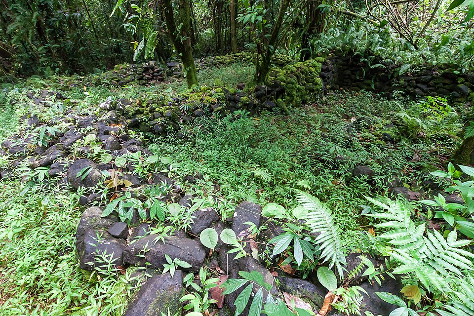
Ground surveys have always been the backbone of archaeology, and for good reason: nothing replaces careful excavation. But walking a site is painfully slow, and in thick forest it is often close to impossible. A team might spend weeks cutting survey lines through undergrowth only to map a few hundred metres, while a monumental structure sits unnoticed a short distance away, disguised as a natural hill.
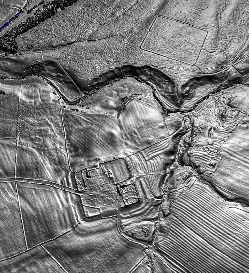
Aerial photography, developed for military reconnaissance in the First and Second World Wars, offered a partial solution. From a balloon or an aeroplane, subtle patterns in vegetation or soil could sometimes betray buried walls and roads. Early aerial archaeologists used exactly this trick to identify Roman forts and Iron Age enclosures across open European farmland. The catch was that it only worked where the ground was visible. Over a rainforest, a camera photographs nothing but treetops, no matter how sophisticated the aircraft. Satellite imagery, which arrived decades later, ran into the same wall: it is extraordinary for tracking large-scale land use, but it still cannot see through solid canopy.
For regions like the Maya lowlands, the Cambodian jungle, or the Amazon basin, this meant that archaeology proceeded one painstaking transect at a time, and vast areas remained, quite literally, blank spots on the map.
Enter LiDAR: The Laser That Sees Through Trees
LiDAR, short for Light Detection and Ranging, solves the canopy problem with a deceptively simple trick. A sensor, mounted on an aircraft or a drone, fires hundreds of thousands of laser pulses down at the ground every second. Most of those pulses strike leaves and branches and bounce straight back. But because a forest canopy is never perfectly solid, a meaningful fraction of the pulses slip through tiny gaps between leaves and reach the forest floor, where they reflect off the actual ground.
The system records the precise time each pulse takes to return, which reveals the exact distance to whatever it hit. Multiply that by hundreds of millions of pulses across a survey area, and you get an enormous cloud of three-dimensional data points. Software can then filter out every point that bounced off vegetation, keeping only the ones that reached bare earth, a process explored in greater detail in how drone LiDAR reveals hidden archaeological sites.
The result is a digital elevation model of the ground surface, as though the entire forest had been erased. Archaeologists have taken to calling this process “digital deforestation,” and the images it produces can reveal walls, mounds, causeways, and reservoirs invisible to the naked eye, even when standing directly on top of them.
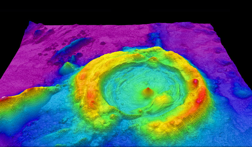
While many early LiDAR surveys relied on helicopters and fixed-wing aircraft, advances in drone technology have made high-resolution archaeological mapping far more accessible. Today, archaeologists use LiDAR-equipped drones to document excavation sites, identify hidden landscape features, create precise terrain models, and monitor sensitive heritage locations with minimal disturbance. These advances highlight the growing role of modern drone applications in archaeology, enabling researchers to survey larger areas more efficiently while preserving fragile cultural landscapes.
Crucially, this no longer requires a research budget on the scale of a national space agency. Drone-mounted LiDAR surveys have brought the cost down enormously, and in several of the discoveries below, existing survey data collected for entirely different purposes turned out to contain lost cities that nobody had thought to look for.
The Lost City of Valeriana: A Maya Metropolis Rediscovered
One of the most striking recent examples happened almost by accident. In 2013, a forest conservation project flew a LiDAR survey over part of Campeche, Mexico, to monitor deforestation. A decade later, Luke Auld-Thomas, then a graduate student at Tulane University, was browsing publicly available LiDAR datasets and noticed unusual patterns in that old survey. Applying the analytical methods archaeologists use to spot buildings and roads, he and colleagues from Tulane, Northern Arizona University, the University of Houston, and Mexico’s national anthropology institute realised they were looking at an entire buried city.
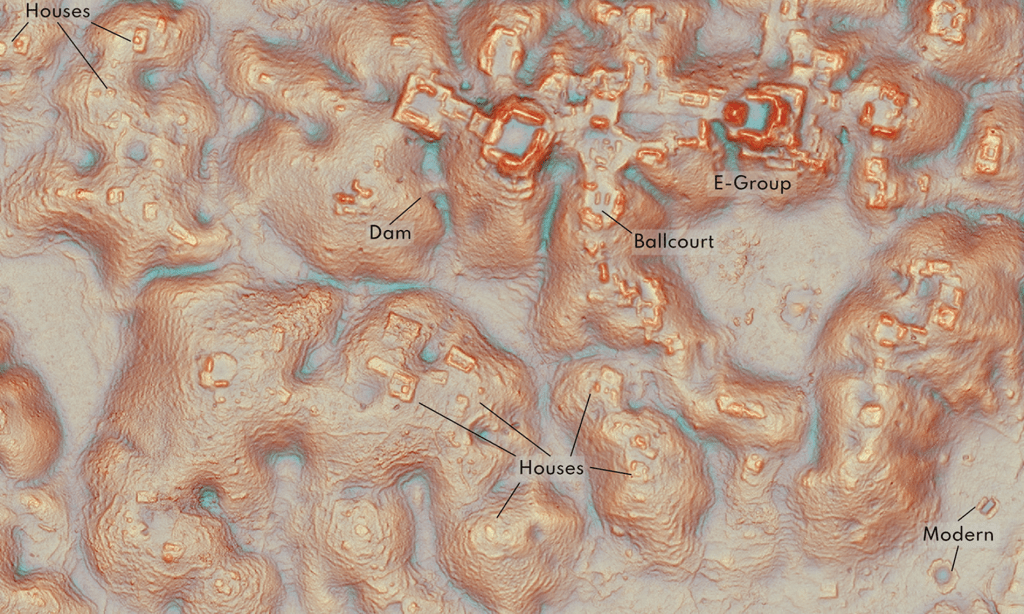
They named it Valeriana, after a nearby lagoon. Across roughly 47 square miles of jungle, the scans revealed thousands of structures: temple pyramids, a ball court, a reservoir, and plazas linked by a broad causeway, all hallmarks of a major Classic Period Maya political capital dating to roughly 250 to 900 CE. In total, the survey identified more than 6,600 structures across Valeriana and the smaller settlements around it, suggesting a city that may have housed tens of thousands of people at its height.
What makes Valeriana remarkable is not just its size, but its location: it sits close to modern farmland and a regional highway, in a spot archaeologists had studied for years without ever suspecting a city was there. As the research team put it, the discovery is a reminder that the gaps in our knowledge of the ancient Maya world are far larger than anyone assumed.
Angkor Wat’s Hidden Sprawl: The World’s Largest Pre-Industrial City?
The temples of Angkor, in what is now northwestern Cambodia, have never exactly been a secret. Angkor Wat is one of the most photographed religious monuments on Earth. But the empire that built it turned out to be far bigger than its temples suggested.
In 2012, a team led by archaeologist Damian Evans strapped a LiDAR scanner to a helicopter and flew it over Angkor and two nearby temple complexes. The results, published the following year, uncovered an entire formally planned urban landscape woven around the famous monuments, extending well beyond Angkor Wat’s moat and quadrupling the known size of the fortified city of Angkor Thom to more than 13 square miles of organised urban space. A further, larger survey in 2015 expanded the picture even more, mapping over 700 square miles of terrain and uncovering additional cities, canals, quarries, and an elaborate network of water management infrastructure connecting settlements across the region.
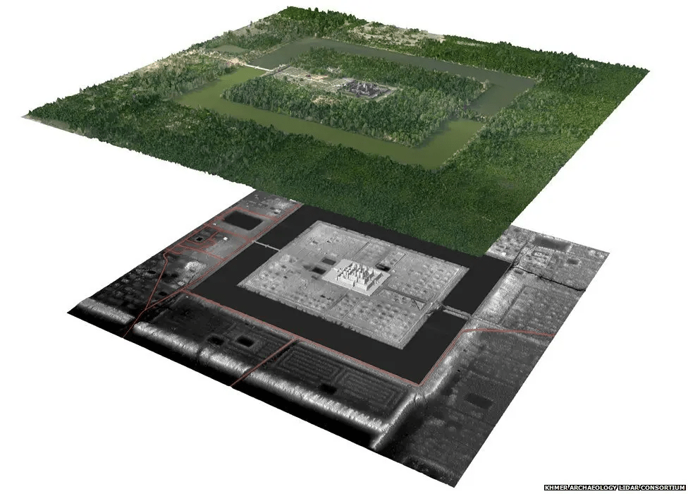
Taken together, these surveys reframed Angkor not as a cluster of temple complexes but as a single, sprawling, low-density urban network that at its height in the 12th and 13th centuries may have been the largest settlement complex on Earth before the Industrial Revolution, spread across roughly 1,000 square kilometres. It is a striking illustration of how LiDAR does not only find cities nobody knew about; it can also reveal that a site everyone thought they understood is many times larger than believed.
Beyond the Jungle: Silk Road Cities and Amazonian Urbanism
LiDAR’s usefulness is not confined to rainforests. In 2024, a team led by Michael Frachetti of Washington University in St. Louis and Farhod Maksudov of Uzbekistan’s National Center of Archaeology used drone-based LiDAR to map two medieval cities perched more than 2,000 metres above sea level in the mountains of southeastern Uzbekistan, an elevation comparable to Machu Picchu. The smaller city, Tashbulak, covered around 12 hectares, while the larger, Tugunbulak, sprawled across roughly 120 hectares and contained over 300 identifiable structures, including fortifications and what may have been an ironworking factory protected by three-metre-thick earthen walls. Historians had long assumed the Silk Road’s mountain passes were simply obstacles travellers endured between lowland trading centres. These cities suggest the highlands were thriving hubs of industry and trade in their own right.
Meanwhile, in the Bolivian Amazon, a 2022 LiDAR survey of the Llanos de Mojos region overturned the long-standing assumption that the rainforest could never have supported large, complex societies. Archaeologists led by Heiko Prümers identified 26 settlement sites belonging to the Casarabe culture, which flourished between roughly 500 and 1400 CE, including two major urban centres, Cotoca and Landívar, covering 147 and 315 hectares respectively. The sites featured stepped platforms, conical pyramids up to 22 metres tall, defensive moats, and causeways radiating out for kilometres to connect a four-tiered network of settlements spread across a territory of about 4,500 square kilometres. It was, quite literally, urbanism that had been sitting under the canopy the entire time.
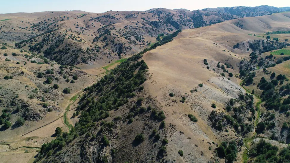
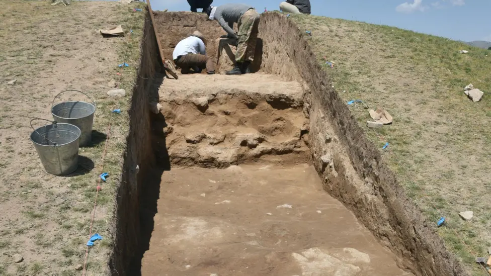
The mountains of eastern Uzbekistan, and walls of Tugunbulak that archaeologists found thanks to LiDAR. BBC.
Rewriting the Map: What These Discoveries Change
Individually, each of these finds is remarkable. Together, they point to something bigger: a pattern of chronic underestimation. Time and again, regions once dismissed as sparsely populated backwaters, whether jungle, mountain, or rainforest, are turning out to have supported dense, interconnected, and highly organised societies.
This is forcing historians to revise population estimates upward, sometimes dramatically, and to rethink how ancient civilisations related to one another. Cities that looked isolated on old maps are increasingly appearing as nodes in much larger regional networks, linked by roads, canals, and shared architectural traditions. The Maya lowlands, the Khmer heartland, the Central Asian highlands, and the Amazon basin are all being redrawn not as scattered outposts but as landscapes that were, in various periods, thoroughly urbanised. It is a genuinely significant shift in how we understand where, and how, large numbers of people chose to live in the ancient world.
What Lies Ahead: The Future of Lost City Discovery
If the last decade has been about proving LiDAR’s power, the next one looks set to be about scale and speed. Vast archives of LiDAR data, originally collected for forestry, flood mapping, or infrastructure projects, sit unexamined in government and research databases around the world, much as the Campeche survey did before Valeriana was found within it. Archaeologists are increasingly turning to machine learning to comb through this data automatically, flagging the subtle geometric patterns, straight causeways, regular mounds, rectangular platforms, that human eyes might miss across thousands of square miles.
Combined with falling drone costs and growing international cooperation on data sharing, this suggests we are still in the early stages of this story. Somewhere in an existing dataset, or beneath a patch of forest nobody has scanned yet, there is likely another Valeriana, another Tugunbulak, waiting to reappear. The jungle has kept its secrets for a very long time. It is only now starting to give them up.
Thank you again to Drone as a Service for this great post, and it’s certainly given me lots that I want to research!
Previous Blog Post: An Interview With: Epoch Bracelets
You may be interested in: Ancient Wonders: The Mahabodhi Temple
List of Blog Posts: here Blog Homepage: here
Buy my books via the pictures below! Or why not check out our shop?




Follow us:


Read more:
National Geographic, LiDAR archaeology coverage
The Guardian, reporting on the discovery of Valeriana
PACUNAM LiDAR Initiative (2018) publication
Cambodian Archaeological LiDAR Initiative (CALI)
Prümers, H. et al., “Lidar reveals pre-Hispanic low-density urbanism in the Bolivian Amazon,” Nature (2022)
Frachetti, M. et al., “Large-scale medieval urbanism traced by UAV-lidar in highland Central Asia,” Nature (2024)
Auld-Thomas, L. et al., Antiquity (2024)

